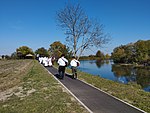
Stari Jankovci
Stari Jankovci | |
|---|---|
Villages of the Municipality of Stari Jankovci | |
 | |
| Coordinates: 45°16′N 18°55′E / 45.267°N 18.917°E | |
| Country | |
| Region | Syrmia (Podunavlje) |
| County | |
| Government | |
| • Municipal mayor | Ivo Lozić (HDZ)[1] |
| Area | |
| 95.2 km2 (36.8 sq mi) | |
| • Urban | 19.6 km2 (7.6 sq mi) |
| Population (2021)[3] | |
| 3,271 | |
| • Density | 34/km2 (89/sq mi) |
| • Urban | 1,124 |
| • Urban density | 57/km2 (150/sq mi) |
| Demonym(s) | Jankovčanin (♂) Jankovčanka (♀) (per grammatical gender) |
| Time zone | UTC+1 (CET) |
| • Summer (DST) | UTC+2 (CEST) |
| Postal code | ? |
| Area code | 32 |
| Vehicle registration | VK |
| Website | o-jankovci |
Stari Jankovci (Serbian Cyrillic: Стари Јанковци, Hungarian: Ivanóc) is a village and a municipality in Vukovar-Syrmia County, Croatia
The village is located to the northeast of the M104 railway route. The village is connected with the rest of the country by the D46 state road connecting it with the town of Vinkovci and continuing into Serbia as the State Road 120 to the nearest town of Šid.
Population
[edit]The population is distributed in the following settlements:[4]
- Novi Jankovci, population 934
- Orolik, population 512
- Slakovci, population 958
- Srijemske Laze, population 572
- Stari Jankovci, population 1,429
The total municipality population was 5,216 in 2001, with 69.50% Croats, 23.24% Serbs and 5.06% Hungarians.
History
[edit]During the Croatian War of Independence, the village was occupied by the rebel Serbs in 1991. The parish church of Blessed Virgin Mary, built in 1780 with a notable Baroque-Classical main altar, was severely damaged.
Stari Jankovci is an underdeveloped municipality which is statistically classified as the First Category Area of Special State Concern by the Government of Croatia.[5]
Name
[edit]The name Stari Jankovci means Old Jankovci, while to the southwest there is a smaller village of Novi Jankovci, meaning New Jankovci.
The name of the village in Croatian is plural.
History
[edit]Traces of continuous human settlement at the area of the municipality are investigated at two prehistoric settlements and one necropolis, one archaeological site from antiquity and medieval necropolis "Balkan".[6] In the area of Jankovci, there was a larger estate whose owner was the nobleman Herka around 1260, and after him duke Pavle Gorjanski. The Turks ruled the Jankovci area from 1526 to 1688. After the departure of the Turks, the Jankovci were part of the Vukovar Manor until 1945 and belonged to civilian Croatia. [7]
Politics
[edit]Municipal government
[edit]The municipality assembly is composed of 15 representatives. As of 2009, the member parties/lists are:[1]
| Party | Number of votes | Number of seats | |
|---|---|---|---|
| Croatian Democratic Union | 611 | 5 | |
| Independent Democratic Serb Party | 433 | 3 | |
| Croatian Peasant Party | 356 | 3 | |
| Independent municipal list-Tado Antukić | 291 | 2 | |
| Croatian Democratic Alliance of Slavonia and Baranja | 132 | 1 | |
| Croatian Party of Rights | 115 | 1 |
Minority councils
[edit]Directly elected minority councils and representatives are tasked with consulting tasks for the local or regional authorities in which they are advocating for minority rights and interests, integration into public life and participation in the management of local affairs.[8] At the 2023 Croatian national minorities councils and representatives elections Hungarians and Serbs of Croatia fulfilled legal requirements to elect 10 members minority councils of the Stari Jankovci Municipality with Hungarians electing full and Serbs 9 members council in the end.[9]
See also
[edit]References
[edit]- ^ a b "Informacija o rezultatima izbora članova predstavničkih tijela jedinica lokalne i područne (regionalne) samouprave" (PDF). Archived from the original (PDF) on 2012-08-13. Retrieved 2013-03-10.
- ^ Register of spatial units of the State Geodetic Administration of the Republic of Croatia. Wikidata Q119585703.
- ^ "Population by Age and Sex, by Settlements" (xlsx). Census of Population, Households and Dwellings in 2021. Zagreb: Croatian Bureau of Statistics. 2022.
- ^ "Population by Age and Sex, by Settlements, 2011 Census: Stari Jankovci". Census of Population, Households and Dwellings 2011. Zagreb: Croatian Bureau of Statistics. December 2012.
- ^ Lovrinčević, Željko; Davor, Mikulić; Budak, Jelena (June 2004). "AREAS OF SPECIAL STATE CONCERN IN CROATIA- REGIONAL DEVELOPMENT DIFFERENCES AND THE DEMOGRAPHIC AND EDUCATIONAL CHARACTERISTICS". Ekonomski pregled, Vol.55 No.5-6. Retrieved 25 August 2018.
- ^ "Općine na područjima posebne državne skrbi Republike Hrvatske" (PDF). Croatian Chamber of Economy. Retrieved 15 April 2020.
- ^ "Stari Jankovci". o-jankovci.hr. Retrieved 2023-02-08.
- ^ "Manjinski izbori prve nedjelje u svibnju, kreću i edukacije". T-portal. 13 March 2023. Retrieved 2 May 2023.
- ^ "Informacija o konačnim rezultatima izbora članova vijeća i izbora predstavnika nacionalnih manjina 2023. XVI. VUKOVARSKO-SRIJEMSKA ŽUPANIJA" (PDF) (in Croatian). Državno izborno povjerenstvo Republike Hrvatske. 2023. p. 21. Retrieved 3 June 2023.


